Pets allowed
Allowed
Elevation Gain
656.00 ft (199.95 m)
Trail type
Loop
Distance
4.40 mi (7.08 km)
Please respect the outdoors by practicing Leave No Trace. Learn more about how to apply the principles of Leave No Trace on your next outdoor adventure here.

The Gateway Loop trail is popular trail in Scottsdale, Arizona.  The trail is a 4.5-mile loop in the Scottsdale Sonoran Preserve. The trail leaves from Gateway Canyon Trailhead in the Scottsdale Sonoran Preserve.  The trailhead has water and flushing toilettes, and hikers need to make sure that have plenty of water on warmer days.  This trail is also pet friendly so expect to see plenty of dogs on trail. While this is a great hike due to it proximity to Scottsdale it is a very busy trail and hikers most likely will see people for the duration of the hike.

The hike begins over a steel bridge and at an every so slight incline.  Hikers will then come to the junction where they can choose to go either clockwise or counterclockwise.  The hike is about the same difficulty level either way so hikers can choose whichever direction suits them. 

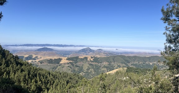
For hikers continuing counterclockwise they will start ascending quickly after leaving the junction and will be graced with views of the McDowell Mountains as the hike further and further from the road.  This portion of the trail offers hikers a sense of wilderness.  Hikers will follow the signs to the Gateway Pass.  Hikers will continue to Gateway Saddle that will be the highest point on the trail.  This is a great spot for hikers to take a rest before returning to the trailhead. For the remaining portion of the trail, hikers will descend until the reach the initial junction that will take them the final quarter mile back to the trailhead.

This best time to hike this trail is late fall, winter, and spring as there is limited shade.  Like all hikes in the area, hikers should take extreme caution when hiking in summer months.  This is a wonderful trail to get outside that is close to the Phoenix metropolitan area.

Logistics + Planning

Preferable season(s)

Winter
Spring
Fall

Congestion

High

Parking Pass

None

Open Year-round

Yes

Pros

Beautiful Scenery.

Cons

Crowded.

Trailhead Elevation

1,719.00 ft (523.95 m)

Highest point

2,392.00 ft (729.08 m)

Features

Family friendly
Flushing toilets
Wildflowers
Big vistas
Wildlife

Typically multi-day

No

Suitable for

Biking

Permit required

No

Location

Nearby Lodging + Camping

McDowell Mountain Regional Park
Superstition Mountains Area, Mesa, Arizona

Comments

Have updates, photos, alerts, or just want to leave a comment?
Sign In and share them.