

You are here
Pets allowed
Allowed
Elevation Gain
4,327.00 ft (1,318.87 m)
Trail type
Shuttle
Distance
17.40 mi (28.00 km)
Please respect the outdoors by practicing Leave No Trace. Learn more about how to apply the principles of Leave No Trace on your next outdoor adventure here.
The crossing from France to Italy is without a doubt one of the highlights of the Tour du Mont Blanc. On a clear day, the crossing into Italy is nothing short of enchanting when Val Veny reveals itself on the opposing flank of Col de la Seigne, and you'll enjoy potentially your first views of Mont Blanc itself if you had a cloudy day when arriving in Chamonix to start the TMB. Stage 3 takes you into the Aosta Valley in Northwestern Italy, which is a semi-autonomous region that remains the smallest, least populated, and least densely populated region in Italy. The Aosta Valley region stays true to the TMB’s official language of French by being the first government authority to make modern French an official language in 1536, three years before France itself made the same proclamation.
Stage 4 takes you into Courmayeur, which is Italy’s sister city to Chamonix, from which the TMB starts and ends. Courmayeur makes an excellent place to spend a rest day, and despite having less than 3,000 residents, it is one of the more bustling centers you will encounter on the tour. Whether you start in Les Chapieux or Refuge Mottets, this section will be less strenuous and one of the highlights of the entire trip.
Starting in Les Chapieux, the obvious choice for lodging that evening is Refugio Elisabetta, which stands as one of the only places in the area that is available for booking for the night. The next place to sleep is a three- to four-hour trek deeper into Italy. If the end of Stage 2 left you spending the night at Les Mottets, it is recommended to press onward to Col Checrouit or Dolonne if you are feeling especially fresh, unless of course time permits or your body demands taking an easy day, in which case Rifugio Elisabetta remains a standard stopping point along the tour.
There is no alternative to crossing Col de la Seigne, not that any sane trekker would ever choose to avoid it. Even in bad weather the exposure here is not as severe as some of the other cols because this crossing is one of the lower and less precarious ones. After a short walk past Rifugio Elisabetta starting Stage 4 there are two options depending on weather and the desired strenuousness of the Trek: You can either trek up toward Mont Favre Spur with the superb close-up balcony views of the Italian side of Mont Blanc, or you can opt to hike along the road down Val Veny to escape the wind-swept ridgelines and knee-pounding descent into Dolonne at the end of Stage 4.
Resupply
- Les Chapieux (small grocery)
- Dolonne (multiple options)
- Courmayeur (multiple options)
Lodging / Cafes
- Les Chapieux (small grocery)
- Les Mottets (refuge)
- Rifugio Elisabetta (refuge)
- Rifugio Maison Vieille (refuge on Col Checrouit)
- Rifugio Monte Bianco (refuge)
- Dolonne (multiple options)
- Courmayeur (multiple options)
Stage 3
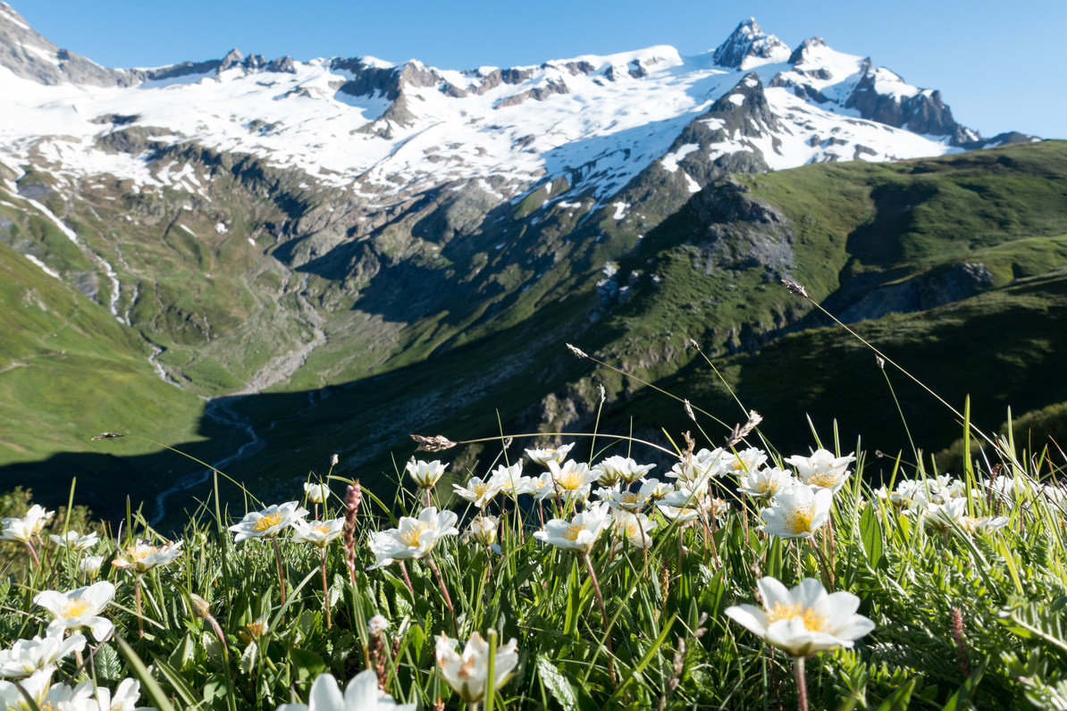

Wildflowers on the climb to Col de la Seigne.
If you are starting in Les Chapieux, the day will be about two hours longer than those who made it to Les Mottets the previous day. Get up bright and early, since the views from Col de la Seigne are more spectacular in the morning light. The signs will point you northeast on the road, and road walking will be the name of the game until you arrive at the lone building of Seloge when the road turns to dirt. It’s at this point that Aiguille des Glaciers begins towering over the head of the valley, and the low point of Col de la Seigne is seen beckoning to the right of the spectacular snow and glacier-laden southern face of the peak.
Ville des Glaciers and Les Mottets both offer water and restrooms, but Les Mottets makes the far better rest stop to tank up on water before tackling the steeper portion of the climb to the Col de la Seigne. After leaving the comfort of Les Mottets, the climb truly begins. While the climb may not be as difficult as some of the others on the tour, it’s still a high mountain pass that reminds you of such as the cairn marking the summit remains twinkling in the distance, always out of reach. In total it is about 640 meters of climbing over 4 kilometers from Les Mottets.
Once you reach the top, keep in mind that the vast expanse beyond is all Italy! On a clear day you can look clear across to see the Grand Col Ferret in the distance, to be climbed in a few days. The ruined shelter of Casermetta makes an excellent way to protect from the wind at Col de la Seigne, the abandoned site that used to house garrisons guarding the crossing between France and Italy.
After descending the other side, the path widens almost to the width of a road before more abandoned buildings can be seen, indicating that the destination of Rifugio Elisabetta draws near. A sign marking the intersection will be all it takes to entice you up the Rifugio for a break, even if your day takes you further. The view here is prime for your first cappuccino in Italy during the trek, and the view from the porch is spectacular. Elisabetta marks the official end of Stage 3, though for those starting at Les Mottets this morning, you may want to continue depending on how many days you have for the full loop.
Stage 4
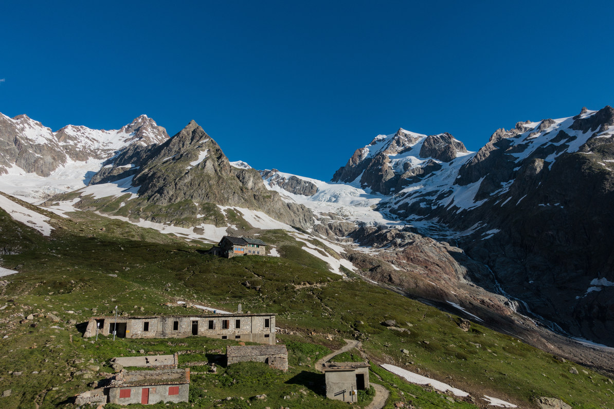

A beautiful setting for the starting Stage 4.
Waking up at Elisabetta has you feeling high in the mountains because you'll be sitting on a hill with the valley pouring out beneath you. The sunrise is definitely worth getting up early for, and you’ll want to because the first part of Stage 4 is a road walk without any shade for about 2.5 kilometers, and you won’t want to do this once the sun is high and baking the valley. Now begins the 2.5-kilometer climb with over 450 meters of elevation gain to the Stage 4 high point (both in terms of elevation and views) at Mont Favre Spur. The view across the Val Veny toward the Italian side of Mont Blanc is likely to be the highlight of your time in Italy, so try to plan this for good weather.
After the highpoint at Mont Favre Spur, the trail descends gradually toward Rifugio Maison Vieille at Col Checrouit along an incredible balcony trail with views from Mont Blanc to the Grand Jorasses. There are several alpine lakes to enjoy and rocky outcroppings that marmots frequent along the route to add to the otherwise very scenic trail to Col Checrouit. At that point, however, a rest and lunch is advised since the trail becomes uncomfortably steep toward Dolonne. The trail will lose around 610 meters in less than 3 kilometers, so keep your trekking poles handy and watch your step.
After entering Dolonne you will have an plenty of options available to you for lodging, food, and anything else you may want. Just across the bridge from Dolonne is the busier and certainly more tourist-centric Courmayeur, where Stage 5 continues the next day. Courmayeur makes an excellent place to restock, refuel, and rest before continuing; the next town with resupply options is at the very end of Stage 7.
For additional coverage of the Tour du Mont Blanc, check out the following articles:
Nearby Adventures

 Overview")

You May Also Enjoy


Comments
Sign In and share them.