

You are here
Pets allowed
Allowed
Elevation Gain
4,261.00 ft (1,298.75 m)
Trail type
Shuttle
Distance
22.80 mi (36.69 km)
Please respect the outdoors by practicing Leave No Trace. Learn more about how to apply the principles of Leave No Trace on your next outdoor adventure here.
From Courmayeur, the second half of your time in Italy promises to be as dramatic as the first. Stages 5 and 6 take you along the ridge of Mont de la Saxe high above Val Ferret toward Rifugio Bonatti and the Grand Col Ferret at the head of the valley, which marks the crossing into Switzerland. At the end of Stage 5 you will have the chance to stay in Rifugio Bonatti, which is named in honor of the Italian hero Walter Bonatti and is one of the best huts along the tour.
Walter Bonatti is regarded widely as one of the world’s most accomplished and important mountaineers of all time, not just in Italy, and he was one of the most inspirational advocates and leaders of the sport. He is most famous for the controversy surrounding the first ascent of K2 in 1954. Members of his team conspired to prevent Bonatti from being part of the summit team in an effort to secure the first ascent for someone closer to the team leader. It is an interesting story that warrants a read; he was vilified for 50 years before the record confirmed that Bonatti’s version of the story was correct. His long list of accomplishments included many first ascents of remote peaks in the Alps, Himalaya, and Patagonia.
Leaving out of Courmayeur, Stage 5 has several variations depending on the desired strenuousness of the day. There are several options as far as lodging goes, but the recommended stop is at Rifugio Bonatti. The main choice that needs to be made regarding the route comes when you crest the ridge at Rifugio Bertone, where you will take either the main path that undulates along the ridge via a grassy balcony trail or the old route along the crest of the ridge and across Col Sapin and Pas Entre-Deux-Sauts. A testament to the incredible views from the high variant is how the the first ascent of one of the high peaks of the mountain was first studied by Edward Whymper in 1865 the day before his team summited. Unfortunately for Edward, he misjudged the highest peak and climbed the slightly shorter (only by 24 meters) second-highest peak, now known as Pointe Whymper. The views, however, come at a cost. The variant includes over 1,525 meters of climbing and will take most fit trekkers an average of 7 hours to complete, compared to the 4 hours via the main route to Bonatti.
Stage 6 has a minor variation after reaching the small hamlet of La Peule, where you can choose to stay on the trail or take the gravel road for the one-hour walk down to Ferret, when the variants converge for the road walk to La Fouly. The differences between these options are minimal, and the decision comes down to preference.
Resupply
- Dolonne (multiple options)
- Courmayeur (multiple options)
- La Fouly (multiple options)
Lodging / Cafes
- Rifugio Bertone (refuge)
- Rifugio Bonatti (refuge)
- Hotel La Vachey (hotel on valley floor)
- Chalet Val Ferret (hotel & restaurant)
- Rifugio Elena (refuge)
- Alpage de la Peule (refuge)
- Ferret (multiple options)
- La Fouly (multiple options)
Stage 5
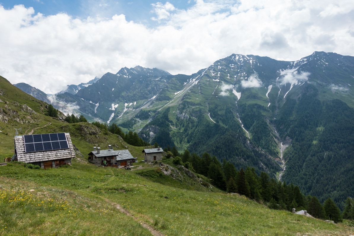

Rifugio Bertone.
Courmayeur makes for an excellent halfway point on the Tour du Mont Blanc due to the liveliness and charm of the mountain town that is a lot smaller than you would expect given the variety of things to do. To punish you for leaving, the very first part of Stage 5 is a relentless climb of over 760 meters to Rifugio Bertone that starts as a walk on pavement and then quickly moves to a trail. The views from the ridge near Bertone over Courmayeur and the surrounding valley are quite magnificent. Rifugio Bertone is an excellent place for a coffee and pastry to either reward yourself for having surmounted most of the day’s climb or to prepare you for the incredibly strenuous day ahead if you are taking the high variant. Following the main Tour du Mont Blanc path, continue uphill to the junction and turn left to the trail that levels out rather than proceeding up the ridge.
From this point onward the bulk of the work is done. Enjoy the balcony path’s views of the immense wall of rock and ice across the Val Ferret toward the Grand Jorasses and the many glaciers falling between her peaks and adjacent mountains. The path will hug the contours of the Mont de la Saxe ridge and provide nearly uninterrupted views both up toward Col Grand Ferret (a hint of Stage 6) and all the way back toward Val Veni (from Stage 4 the previous day). Make sure to keep an eye out for flowers along this section, as the grassy open meadows blossom brightly throughout the summer where you’ll find fields of globe flower and alpenrose.
Several ruins of failed villas, pastures, and hotels will make for points of interest during the afternoon, but the final steep (though short) climb to Bonatti will let you know when the day is through. If you do not have reservations and Bonatti is full, a trek down to the valley floor taking a little over an hour can get you to Hotel La Vachey as an alternate place to stay the night.
Stage 6
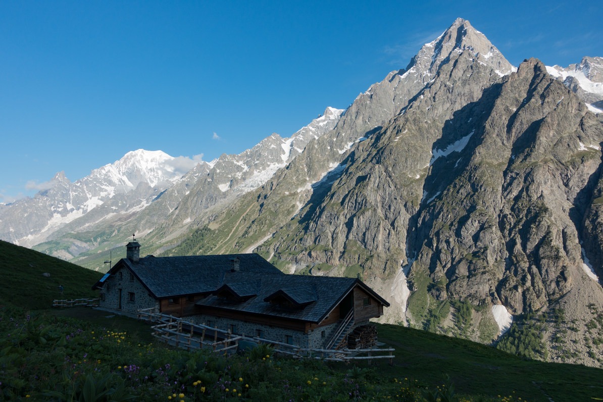

Rifugio Bonatti with Grand Jorasses in the background.
If you were lucky enough to stay at Rifugio Bonatti for the night, make sure to savor the opportunity by waking up for sunrise. The views of the burning orange morning light reflecting on the snow dome of Mont Blanc may provide the best photo from Bonatti, though it is a close competition with the prominent stone towers of the Grand Jorasses catching the early rays. In either case, you are the winner. After breakfast, continue through the pastured balcony trail similar to Stage 5, taking in the early morning light dancing on the rock across the valley until you reach a ruined structure without a continuing path. Take a sharp left to stay on the TMB and follow it down to the valley floor toward Chalet Val Ferret.
After a short walk along the road, the signs will take you back to a singletrack trail that climbs steeply through fields of wildflowers toward Rifugio Elena, which typically includes many globe flowers. After climbing for almost 1,000 feet, Rifugio Elena is very inviting for refreshments prior to the steeper and more punishing completion of the climb to Grand Col Ferret. Upon making the summit, Switzerland now welcomes you with sweeping vistas of the valley beyond. A true sense of accomplishment is always gained from the summit of any climbed mountain pass, but a look behind you toward pieces of Stage 3 at the upper end of Val Veni remind you of how much ground has been covered in a few short days.
In early summer, the northern slopes of the descent from Grand Col Ferret will likely still be dotted with sizable snowfields, but the slopes are gradual, so the most likely consequence from this is only going to be wet shoes from the soft afternoon slush. If the clouds are keeping away, or they are at least high in the sky, make sure to pay attention on the way down for any obvious boot-paths up the slope on the left; there are several opportunities to use these side trails to gain views of the whole Swiss valley that will be walked as part of Stage 7. Make sure to take advantage of this if the conditions are right as the path drops too low before turning toward La Fouly, so this would be your only way to get a straight view down the gorge.
Once you make it to La Peule, after choosing whether to stop for refreshment or not, continue onward either on the standard TMB or along the road toward the bridge across the river. The views and conditions of either choice won’t make more than an hour's difference because they meet back up at Ferret, which makes a closer alternative to stopping at La Fouly. If you'll be continuing onward to La Fouly, head back into the woods and stay along the river until you cross back for a short road walk to La Fouly. From Ferret, it should only take 45 minutes. Thus ends your time in Italy; think back on it fondly, but also look forward to the next two stages in Switzerland.
For additional coverage of the Tour du Mont Blanc, check out the following articles:
Nearby Adventures

 Overview")

You May Also Enjoy


Comments
Sign In and share them.