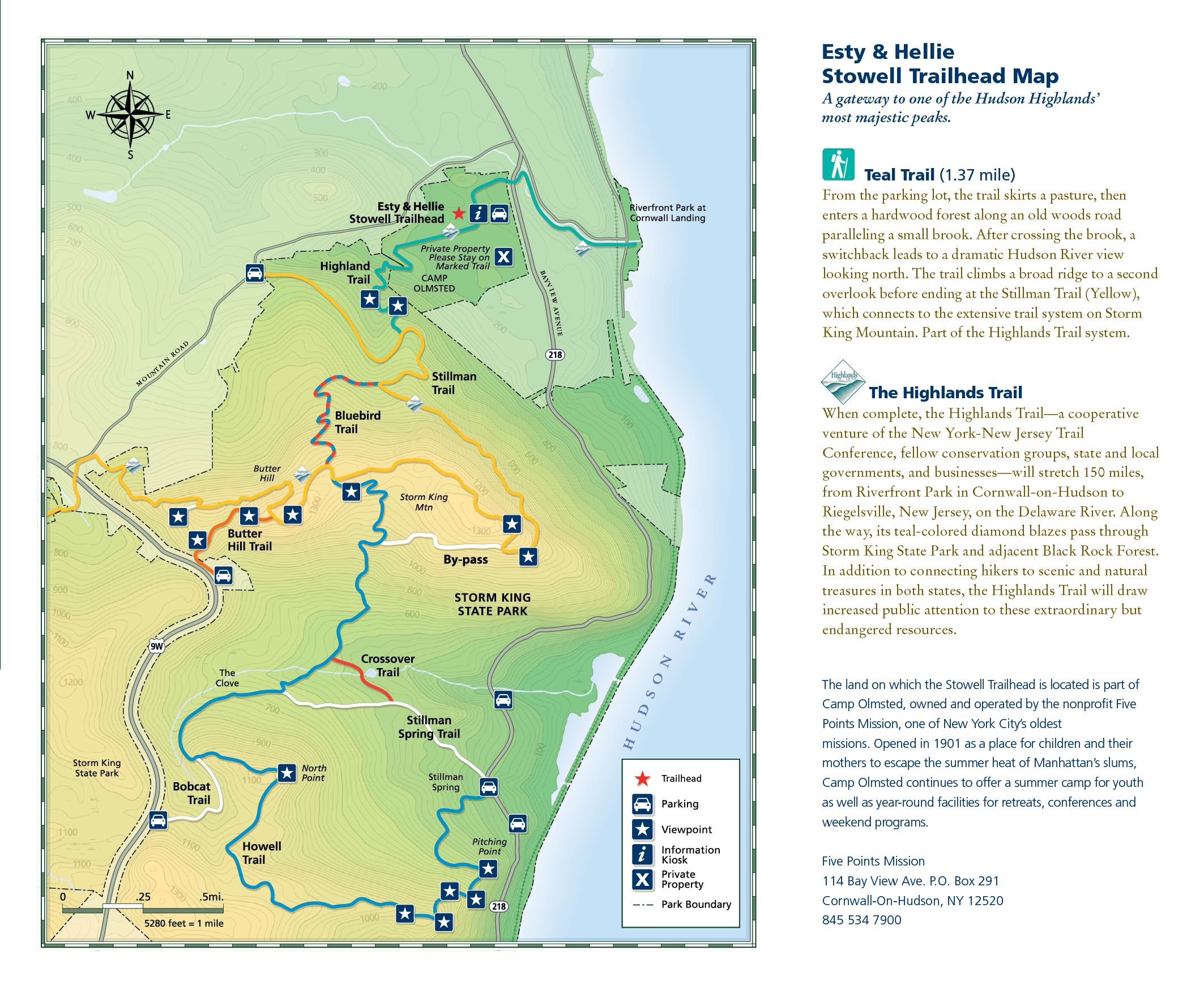
Butter Hill attributes its name to Dutch origins from the colonists who referred to it as Boterberg due to its perceived resemblance to a lump of butter. It is a second peak of Storm King Mountain that sits 40 feet higher about a half-mile to the southwest. An approximately 2-mile loop will take visitors up 500-feet to a 1,380-foot peak overlooking Storm King State Park and the Black Rock Forest to the southwest. Along your journey, you will traverse a scenic cliff with some steep climbs and historic ruins. Scenic Hudson, a land conservancy group, has a published map of the area to help you navigate your route.
The trailhead begins at a scenic lookout and picnic area off of U.S. Route 9W. If you are travelling from the north, there are no turnoffs to the trail, so you will need to head about 3 miles further south and make a U-turn via the off-ramp on Route 218. Picnic tables are situated here along a high bank overlooking a valley that dips down to the Hudson River. A large information board can be found here along with two memorial signs at the trailhead; one commemorates the construction of the Storm King Bypass, while a second one honors the Freedom Road, the route traveled by the 52 American hostages from Stewart Airport to West Point after their release from captivity in Iran. Look for the orange blazes that begin near the road.
The trail will begin in the westward direction as you start your ascent. It will quickly climb to the north as you traverse higher above the highway. To the south you can see North Point and more of the Hudson River Valley comes into view. Mountain laurel and northern hardwoods will line your path as you gain elevation. The peak will emerge as a large rock protrusion sticking up from the pathway. At the top you can see Hudson Highlands State Park to the east, the Shawangunk Ridge beyond Stewart International Airport to the west, and up the Hudson River Valley north to the Catskill Mountains. From this point you can head back down the mountain the way you came or continue the trail loop.
Make a right to the east following the yellow-blazes. Continue up and over the final peak and onto the intersection with the the Clove Trail. Follow these blue blazes to the east and south while capturing a few more views out over the river. Stop at the intersection with the white trail. While it does not appear on the map, the white blazes extend in both the east and westward directions. Follow these white blazes to the west. The trail will rise and dip as you traverse the mountainside. There will be one final climb that emerges at the picnic area where you began your adventure.
Storm King State Park
Located on the west bank of the Hudson River in Cornwall-on-Hudson, this park covers 1,972-acres and several peaks. The steep sides and rounded tops of these mountains, carved out by the last ice age, create a significant bend in the river, which marks the beginning of a fjord that stretches south to West Point and Bear Mountain State Park. The main peaks are Storm King Mountain, Butter Hill, Pitching Point (along the North Point Ridge), and each of the trails follows steep and quick ascents to their respective summits. This entire state park is graced with many viewpoints overlooking the Hudson Valley in all directions. Directly across the river is Hudson Highlands State Park, where Breakneck Ridge and Mount Taurus are the most prominent summits in view to the east. To the south you can see Constitution Island, where one of several chain booms was located during the Revolutionary War to prevent enemy ships from sailing up the Hudson River. You may also enjoy snowshoeing these trails in the winter because the valley is shadowed by the surrounding peaks and maintains the snow for longer periods of time than the surrounding areas.


Comments
Sign In and share them.