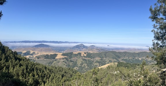
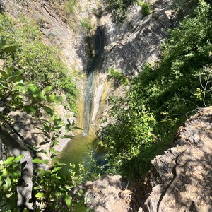
This one is a doozy! Starting and ending at Grizzly Flat, this peak to peak route ascends and descends both Mount Lukens and Condor Peak in Angeles National Forest, coming in at 30 miles. Trail runners and ambitious hikers will find some challenging elevation and beautiful views of the surrounding San Gabriel Mountains. Though seasonal streams are sometimes running, they cannot be relied upon, so make sure that you have plenty of water. Also, it is important to note that the Big Tujunga River will have to be crossed near mile 9.6. The river can flow very high in wet years and can make for a difficult crossing. If the river is too high to cross safely, you might have to turn around for a round trip of Mt. Lukens.This area is very exposed and offers little relief to rain or heat, depending on the season. There are portions of this trail, usually on the north side of Lukens and the final ascent of Grizzly Flat from Stoneyvale, that are infrequently maintained and may require some bushwhacking.
The route begins at Grizzly Flat Trailhead. There is a small parking area off of Highway 2. From the trailhead, the route climbs to a ridge looking out into Big Tujunga Canyon. There is a slight reprieve from the climb here before ascending the southeast slope of Mt. Lukens. At 6 miles and after a winding truck trail, the Lukens summit lies amongst a whir of industrial activity and cell towers. The descent of Lukens’ north side is noticeably more steep than its other, friendlier approaches, and this is where some bushwhacking may slow you down at times. This sharp descent leads down into Big Tujunga Canyon to Big Tujunga River. Cross as safely as you can, though note that your feet may get wet! After crossing, follow Stoneyvale Road for 1.5 miles or so, and then up to the highway for a short jaunt. Near mile 11, there is an access trail from the highway to meet up with the Condor Peak Trail. This is an impressive and newly finished trail, built and maintained by the Lowelifes Trail Crew, that climbs steadily all the way to Mendenhall Ridge and its endless possibilities. For our purposes, however, the route summits Condor Peak near mile 19 before turning around for the homestretch. Instead of taking Lukens back up, this route recrosses Big Tujunga River and ascends the singletrack (sometimes bushwhacky) to Grizzly Flat. This final ascent is no less grueling than the two main climbs, and it is easy to curse here. Bring food, bring water, and good luck on the challenge!


Comments
Sign In and share them.