Please respect the outdoors by practicing Leave No Trace. Learn more about how to apply the principles of Leave No Trace on your next outdoor adventure here.
Starting at a mere 450 feet above sea level and gaining more than 10,000 feet by its end, no single trail in the country gains more elevation than Cactus to Clouds. Many use this hike to train for high altitude climbs in the High Sierra and Alaska. Most hikers start between 2:00 a.m and 4:00 a.m. because beginning any later than that means exposing yourself to the extreme desert heat. Be sure to bring 3 to 5 liters of water, food, warm clothes for the higher elevations, and equipment to help with higher-elevation snow and ice if necessary.
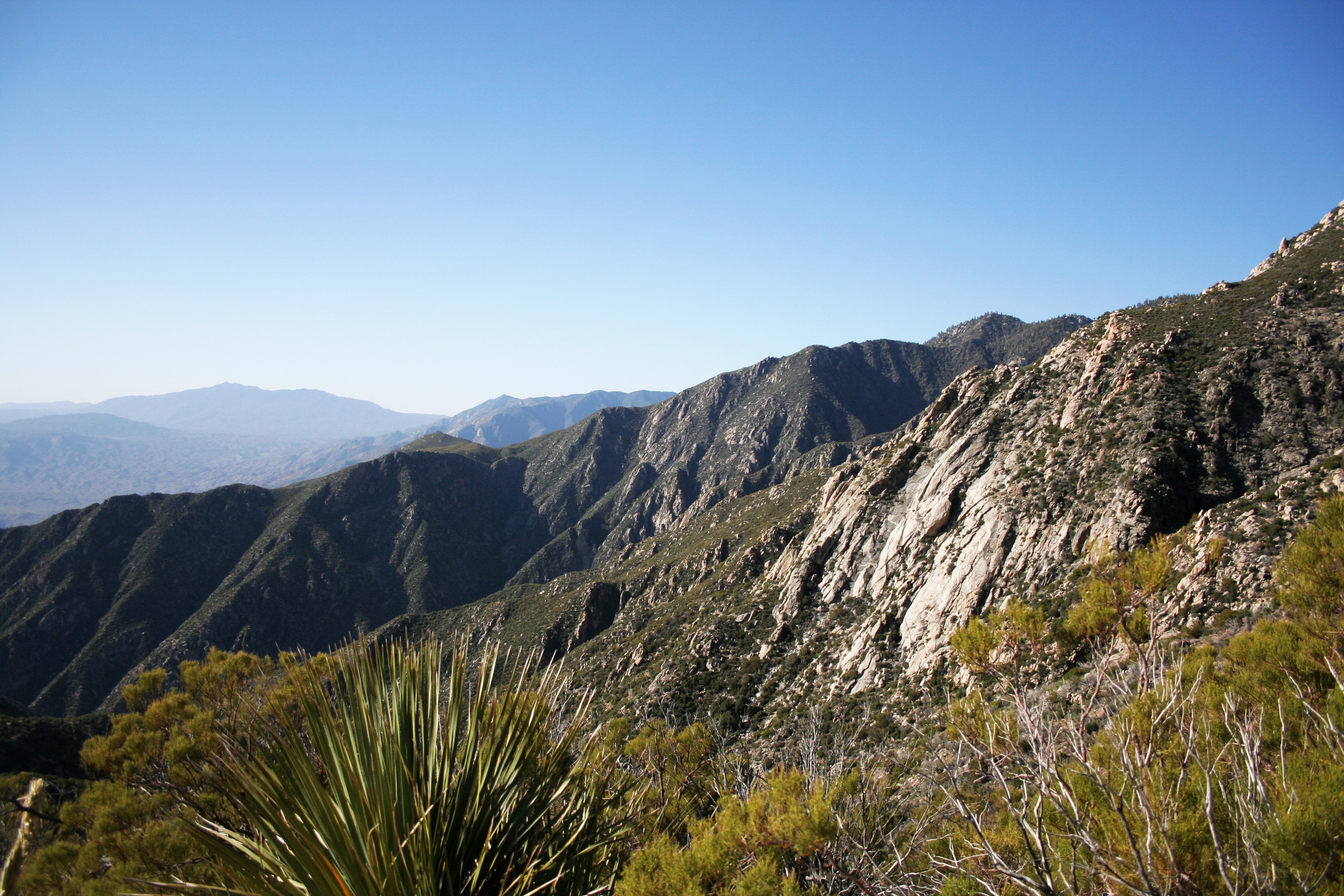
Ideally you will reach 4,000 feet for what is usually an amazing sunrise. From that point on it’s a race to the trees, which begin around 6,000 feet; here you can escape the sun's heat and take solace in the shade of the pines. Be sure to keep your eyes on the trail, however, as the route from the treeline to the ranger station is quite a rock scramble. Once you make it to the ranger station, congratulate yourself for gaining over 8,000 feet from the trailhead, and take comfort in knowing that you are more than halfway finished! Many teams will have a meal and take a nap before continuing on.
After getting your free hiking permit from the ranger station, continue to the summit that is only 5.5 miles away. This section of the hike varies greatly with the seasons. It can be completely covered with snow or it can be over 80 degrees, so be sure to plan accordingly. Enjoy the mellow climb through the forest as the trial moves along several creeks and waterfalls before making the final scramble to the 10,834-foot summit.
From the top, the return trip is quite easy. Most hikers who complete Cactus to Clouds choose to hike back down the 5.5 miles to the ranger station and take the tram to the valley floor. If this is your choice, be sure to arrange for a pick-up at the bottom tram station; alternately, you can always try talking to people in the tram terminal who would most likely be happy to give you a ride back to your car at the museum after hearing your story. If that fails, you can hire a taxi for around $20.
Logistics + Planning
Preferable season(s)
Spring
Fall
Congestion
Low
Parking Pass
Not Required
Pros
Expansive views. Multiple climate zones. Pride in accomplishment.
Cons
Sporadic weather. No trail markings. Almost no water.


Comments
Sign In and share them.